Trail & Tarp earns a commission from qualifying purchases made through links on this page, at no extra cost to you. Full disclosure.
What a contour line is
The short answer
A contour line joins points of equal elevation. Walk along one and you neither climb nor descend. Lines close together mean steep ground; lines far apart mean gentle ground; no lines means flat. That is the entire concept, and everything else on a topographic map is built on it.
The vertical distance between adjacent lines is the contour interval, and it is printed in the map margin. On a US Geological Survey 1:24,000 quadrangle it is commonly 20 or 40 ft depending on the terrain; on metric maps it is usually 10 or 20 m. Every fourth or fifth line is drawn heavier and labeled with its elevation — those are index contours, and they are how you read height quickly.
Check the interval before doing anything else. The same hill drawn at a 10 ft interval and a 40 ft interval looks completely different, and misreading it is how people plan a walk with four times the climb they expected.
Reading landforms
Pattern on the map
What it is
How to recognize it
Concentric closed loops, smallest in the middle
A summit
Elevations increase inward
V shapes pointing uphill
A valley or gully
The V points toward higher ground; water runs through it
V or U shapes pointing downhill
A ridge or spur
The nose points away from high ground
Two summits with a low between them
A saddle or col
An hourglass of contours; usually the easiest crossing point
Lines very close, almost touching
A cliff or crag
Often shown with a hatched or rock symbol as well
Closed loops with inward tick marks
A depression or hollow
The ticks point downhill into the low ground
Six patterns that cover almost every landform a camper will meet on a map.
The V rule is the one worth memorising, because it is counter-intuitive and it is what tells valleys from ridges. Contours crossing a stream form a V that points upstream, which is uphill. On a ridge the same shape points downhill.
Scale, and what it means on the ground
Scale is a ratio: at 1:24,000, one inch on the map is 24,000 inches — 2,000 ft — on the ground. At 1:25,000, four centimeters to the kilometer. At 1:50,000, two centimeters to the kilometer and half the detail.
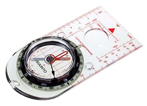
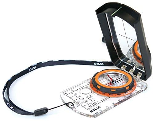
For walking, 1:24,000 or 1:25,000 is the useful range: enough detail to see individual features, small enough area to fit a day's walk on a sheet. This is also why a compass baseplate with the matching romer scales saves time — a Suunto M-3 publishes scales for cm, 1:20,000, 1:25,000, 1:50,000, inch, 1:24,000 and 1:50,000, and a Silva Ranger 2.0 publishes romers for 1:24,000, 1:25,000 and 1:50,000. Measuring distance becomes reading rather than arithmetic.
Read the margin before the map
The margin carries the four things that make the map usable: the scale, the contour interval, the magnetic declination for the sheet and its date, and the legend. Declination in particular drifts over time, so an old map's printed value may be several degrees out — check the current figure with the NOAA calculator and set your compass to that, per best compasses for hiking.
Estimating a walk from the map
Two numbers give you a usable time estimate. Distance, measured along the route with the compass baseplate scale or a piece of string. And total climb, counted by adding up the contour lines you cross going uphill and multiplying by the interval.
A long-standing rule of thumb, Naismith's rule, allows about one hour per 3 miles (5 km) on the flat plus an extra hour per 2,000 ft (600 m) of ascent. It is a planning estimate rather than a promise: it assumes fit walkers, good ground and no stops, so add substantially for a loaded pack, rough terrain, poor weather or children.
The climb figure is the one beginners underestimate. A three-mile walk with 2,000 ft of ascent is a completely different afternoon from a three-mile walk on the flat, and only the contour lines tell you which one you have planned.
What maps do not show
Ground conditions. A flat area may be bog. A gentle slope may be scree. Maps show shape, not surface.
Current access. Trails close, bridges wash out, land changes hands, and forest roads gate seasonally.
Vegetation density beyond broad symbols. “Forest” covers both open pine and impenetrable scrub.
How old it is. Check the revision date in the margin; some sheets are decades old and rivers, tracks and treelines all move.
This is why the land manager's current information matters alongside the map, particularly for dispersed camping where forest road conditions are the deciding factor — see dispersed camping for beginners.
Paper and digital together
Digital maps are excellent and they have one weakness: the battery. Download offline tiles before losing signal, keep the phone warm in cold weather so its capacity does not collapse, and carry the paper sheet as the thing that still works afterwards.
Keep the paper map in a waterproof case, because paper in rain lasts about ten minutes. And practice on it somewhere you already know, which is the only way the pattern recognition sticks — the two techniques that use it are in how to navigate without a phone.
The gear this page points to
Suunto M-3 Baseplate Compass
Suunto
Scales for cm, 1:20,000, 1:25,000, 1:50,000, inch, 1:24,000 and 1:50,000 on the baseplate. Measuring distance becomes reading rather than arithmetic.
Each line joins points of equal elevation, so walking along one involves no climb or descent. Lines close together mean steep ground and lines far apart mean gentle ground. The vertical gap between them is the contour interval, printed in the map margin.
QHow do you tell a ridge from a valley on a topographic map?
By which way the V shapes point. Contours crossing a stream form a V pointing upstream, which is uphill, so a V pointing toward high ground is a valley. On a ridge the same shape points downhill, away from the high ground.
QWhat map scale is best for hiking?
1:24,000 or 1:25,000 - enough detail to pick out individual features, over a small enough area to fit a day's walk on one sheet. At 1:50,000 you get twice the area and half the detail, which suits route planning better than navigation.
QHow do you estimate how long a walk will take from a map?
Measure the distance and count the contour lines crossed going uphill to get total climb. Naismith's rule allows about an hour per 3 miles on the flat plus an hour per 2,000 ft of ascent - a planning estimate that assumes fit walkers, good ground and no stops.
Sources
Every figure on this page comes from a published source. We have not tested this gear, so the numbers are the manufacturer's or the standard body's, not ours. How we research.